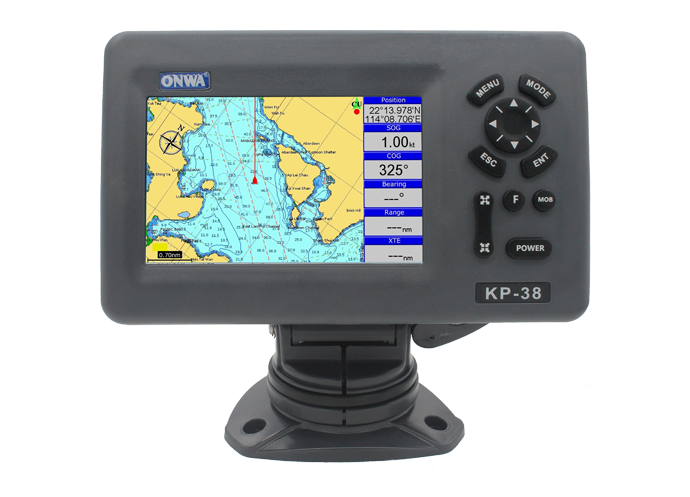


GPS Plotter KP-38S 5''
5-inch GPS Chart Plotter (Power Bank Supply)

Περιγραφή
- 5-inch Colored LCD Display
- Powerbank Supply Capability
- Can work up to 24 hrs with 10,000 mAh power bank
- Save mode feature for lesser power consumption
- K-Chart 3.0 Supported
- Dual Mapping System: K-Chart and C-map Max Compatible
**NOTE: NO NMEA Capability for KP-38S
PLOTTER SPECIFICATIONS |
|
| 1. WAYPOINTS/ ICONS | 12,000 user waypoints with name, symbol, 3 system waypoints: MOB,Start,cursor 10 proximity waypoints |
| 2. ROUTES | Max: 30 routes and up to 170 points for each one |
| 3. TRACKS | 8,000 point automatic track log; 10 saved tracks (up to 8000 track points each). Lets you retrace your path in both directions |
| 4. ALARMS | XTE, Anchor drag, arrival, speed, voltage, proximity waypoint and time,AIS alarm. |
| 5. PALLETE |
|
| 6. TIDES | Tide data |
| 7. PROJECTION | Mercator projection |
| 8. POSITION FORMAT | Degree of minutes and UTM |
| 9. BASEMAP | Built-in Onwa K-Chart |
| 10. EXTERNAL MAP | SD Cards slot for C-Map MAX and ONWA K-Chart |
| 11. USER DATA STORAGE | Internal backup of user settings |
| 12. PLOT INTERVAL | 5s to 60min. 0.01nm to 10nm Automatic way |
| 13. PLOTTING SCALES | 0.001nm to 1,000nm |
| 14. PERSPECTIVE VIEW | On/off |
| 15. CELESTIAL | Sunrise/Sunset Moonrise/Moonset |
POWER SUPPLY |
|
| POWERBANK SUPPLY | |
PHYSICAL |
|
| 1. SIZE | 169mm(H) X 198.1mm(W) X 137mm(D) |
| 2. WEIGHT | 0.56kg |
| 3. DISPLAY | 5-inch Color TFT dayview LCD,800×480 pixels |
| 4.WATERPROOFING | Display unit: IPX5 Antenna Unit: IP66 |
| 5. TEMPERATURE RANGE | Display unit: -5℃ to +55℃ |
GPS RECEIVER CHARACTERISTICS |
|
| RECEIVER | 50 parallel channel GPS receiver continuously Tracks and uses up to 50 satellites to compute and update your position |
| ACQUISITION TIME | Cold start: 60 seconds average |
| HOT START | 45 seconds average |
| UPDATE RATE | 1/second or 10/second (selectable) , continuous |
| POSITION | 2.5 meters (95%) without S/A |
| VELOCITY | 0.1 Meter/sec without S/A |
| TIME | 100ns synchronized to GPS time |
Τεμάχια ανά συσκευασία:1